OpenPFD
Application · Flight instruments / Android · 2026
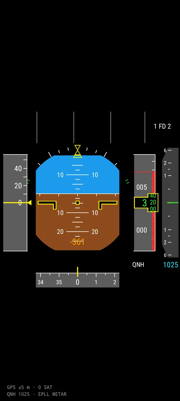
An Airbus, Boeing or G1000 primary flight display driven by real data from the phone’s sensors and GPS.
Realistic flight instruments for Android: PFDs from several aircraft and analogue panels for a Cessna, a Robinson and a glider, fed by the gyroscope, GPS, barometer and METAR.
Pitch and roll come from the rotation vector, speed and the flight path vector from GPS with WMM magnetic declination, and altitude from the barometer. QNH is taken from the nearest METAR, and 3D terrain and radio altitude from the Copernicus DEM model.
You can choose the A320, ATR 72-600, Boeing 737 and 787, Embraer E190 and a Garmin G1000 with synthetic vision, plus analogue panels. Altitude callouts, “bank angle”, “sink rate”, “pull up” and an audio glider variometer all work.
Features
- PFDs of six aircraft and the G1000 SVT
- QNH from the nearest METAR
- 3D terrain and radio altitude
- cockpit-style audio warnings
- not for real navigation
Technology
- Kotlin
- Canvas
- Android Sensors
- METAR
- Open-Meteo
My role
Design, architecture, implementation and releases