FS Opendata Scenery
Application · MSFS 2024 scenery generator / Windows
Your area in Microsoft Flight Simulator 2024 – more accurate terrain and real-world lighting, from open data.
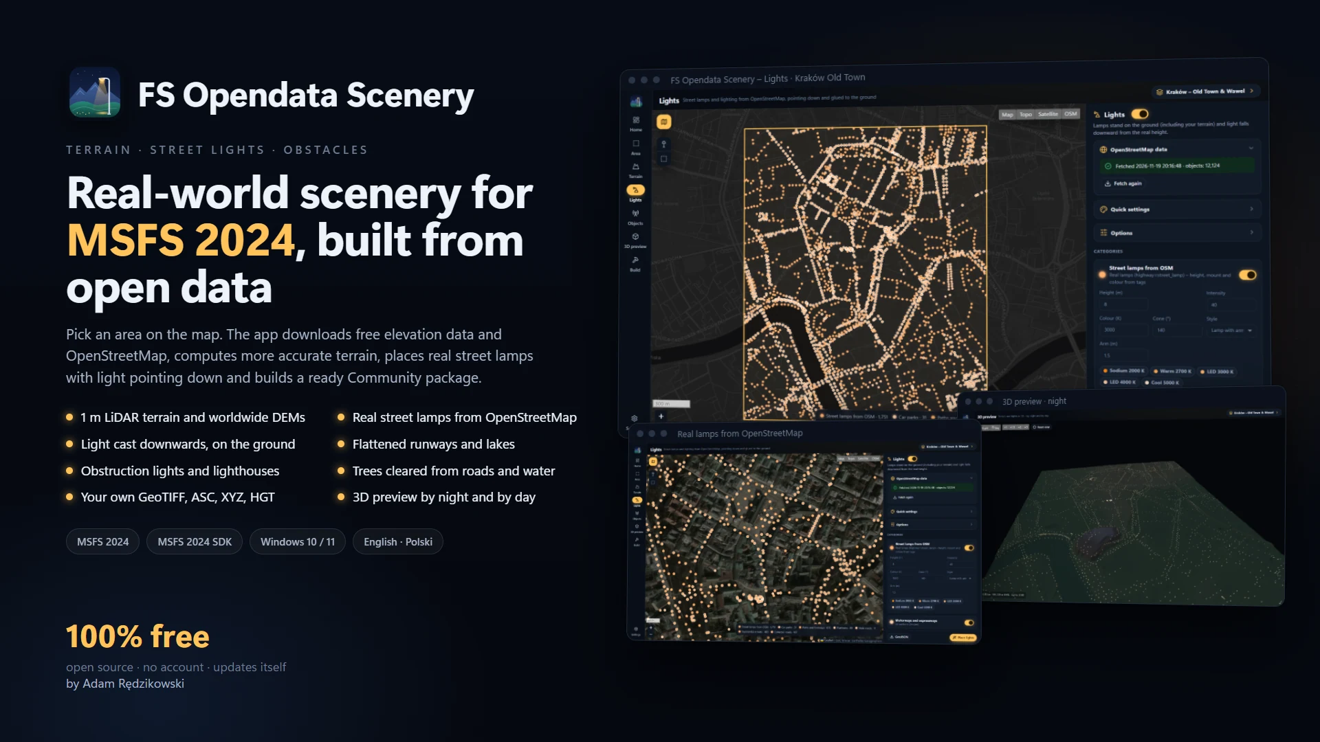
Draw an area on the map and the app downloads free elevation data and OpenStreetMap, computes the terrain, places real street lamps with light pointing down, adds obstruction lights and lighthouses, clears trees from roads and water, and builds a ready package for the Community folder.
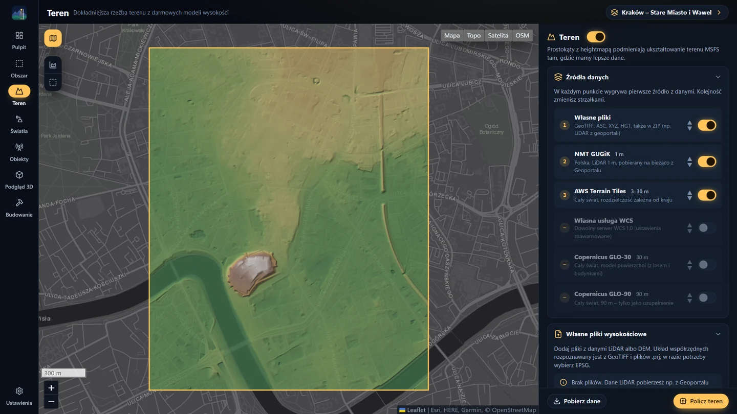
Terrain is built from several sources at once and at each point the first one with data wins: the 1 m LiDAR terrain model from GUGiK for all of Poland, AWS Terrain Tiles and Copernicus for the rest of the world, or your own GeoTIFF, ASC, XYZ and HGT files. The app converts coordinate systems itself – from the Polish grids and UTM to Swiss LV95, Dutch RD and the British National Grid – and splits the area into seamless height-map rectangles with smoothing, a gentle blend into the simulator terrain and flattened lakes.
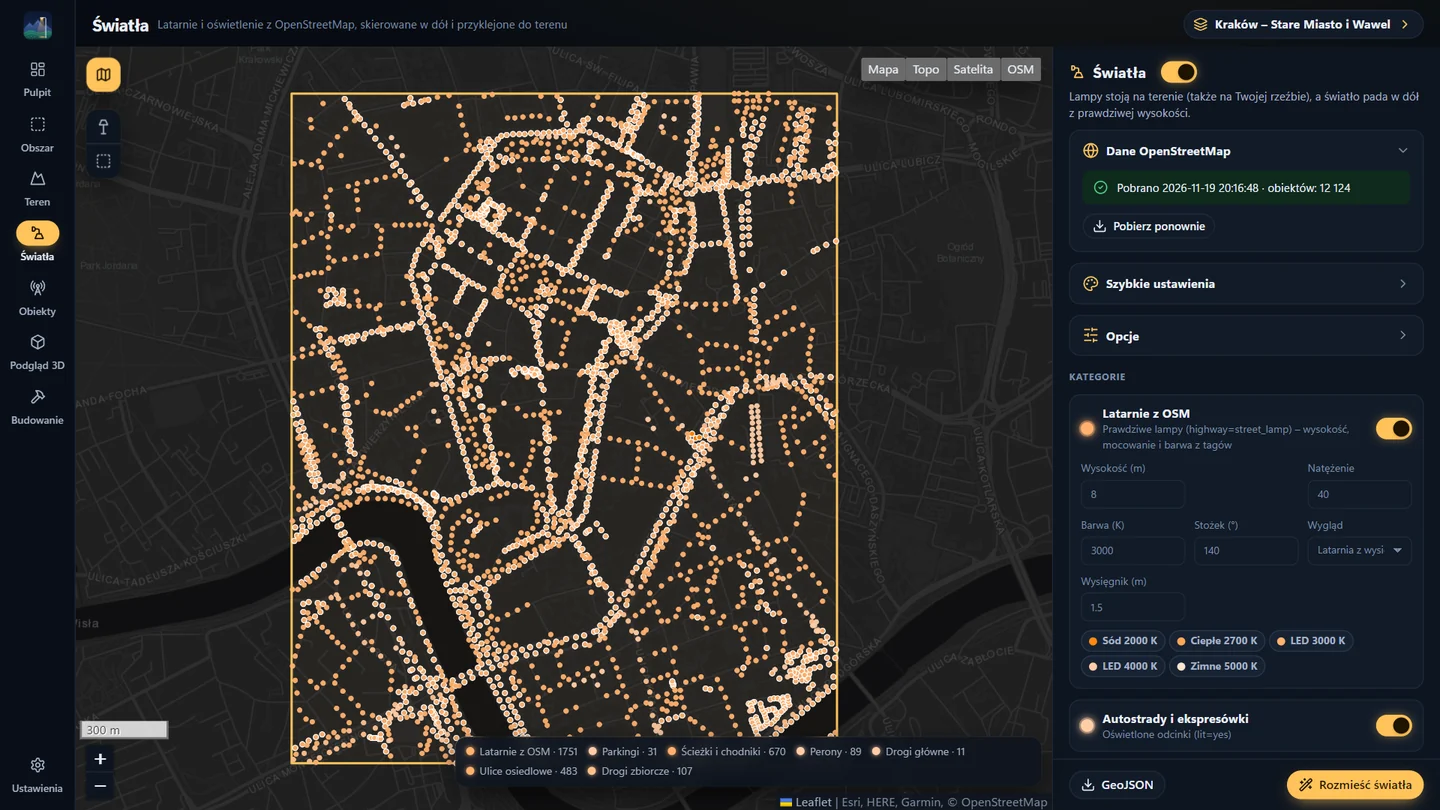
Lighting comes from OpenStreetMap: real street lamps with height, mounting and colour from their tags and the arm turned over the road, plus lit streets, paths, car parks, pitches with floodlights aimed at the field, platforms and fuel stations. Lamps are procedural 3D models with light falling downward, glued to the ground – including the new terrain. Masts, chimneys and wind turbines get obstruction lights and lighthouses their real flash pattern.
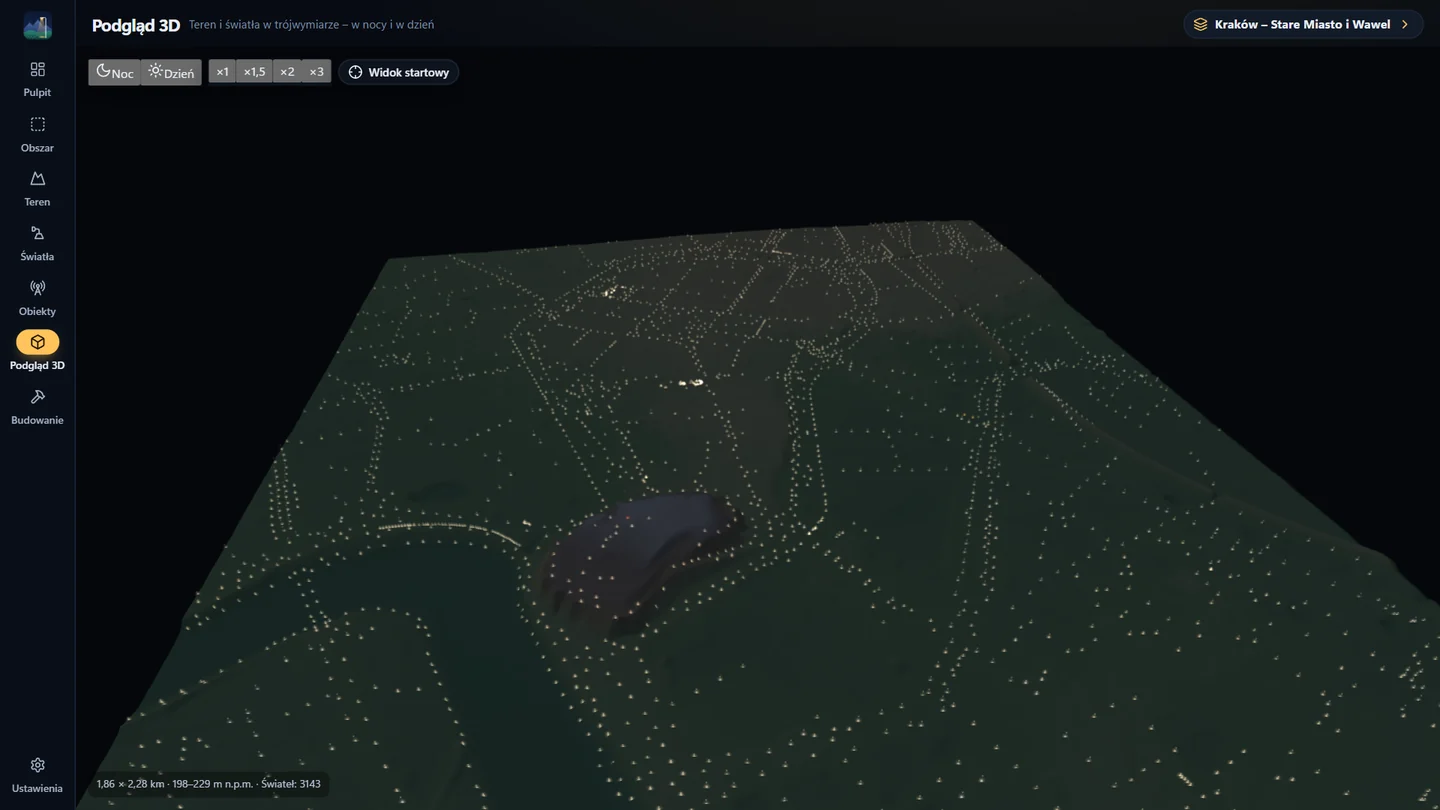
The package is compiled by the official MSFS 2024 SDK tool and installed into Community with one click. Before building you can check everything on the map and in a 3D preview by night and by day. Interface in Polish and English; updates and feedback go through redzikowski.com. Written in Rust with Tauri.
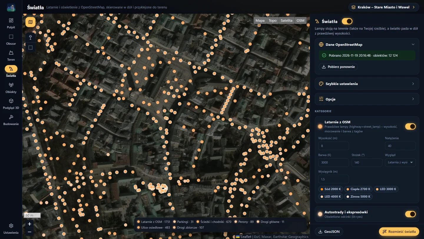
Features
- terrain from GUGiK 1 m DTM, Copernicus and AWS Terrain Tiles
- your own LiDAR: GeoTIFF, ASC, XYZ, HGT
- street lighting from OpenStreetMap, light pointing down
- obstruction lights, lighthouses, tree removal
- 3D preview by night and by day
- compiled with the MSFS 2024 SDK and installed into Community
Technology
- Rust
- Tauri
- JavaScript
- Leaflet
- three.js
- glTF
- MSFS 2024 SDK
My role
Design, elevation and OSM processing, 3D models, interface and releases
Download
Frequently asked questions
Where does the elevation data come from?
In Poland from the GUGiK 1 m terrain model, worldwide from AWS Terrain Tiles and Copernicus. You can also add your own LiDAR files.
Do I need the MSFS 2024 SDK?
To compile the package, yes – the SDK is free and installs from the simulator developer mode. Without it the app saves complete project sources.
Where do the street lamps come from?
From OpenStreetMap: real lamps from the map plus lit roads, car parks, pitches and platforms, with height, colour and direction.